2021 - L'Erma di Bretschneider
Artikel PDF (0,54 Mb)
Nur mit Adobe Acrobat Reader kompatibel (lesen Sie mehr)
Nuovi dati sullo studio topografico della penisola di San Vito Lo Capo
P. 68-95
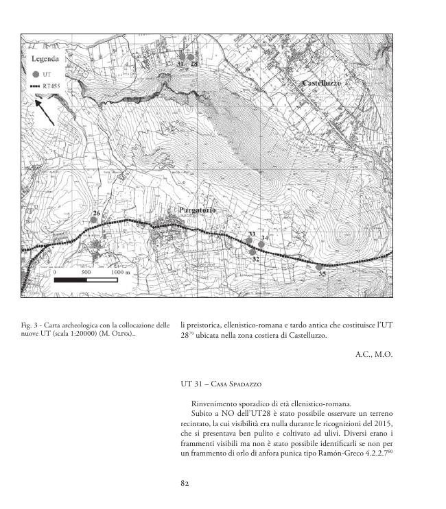
The researches in the municipality of San Vito Lo Capo, begun in 2014 and reported in this article, are the result of an observationand study of the coastal territory and internal carried out in order to have a creare picture of the archaeological risk and archeology in an area that has always only been touched by research. The peninsula of San Vito Lo Capo, still largely virgin, takes its name from the Cape San Vito, the tongue of land that represents its final part, and extends between the village of Purgatorio to the South and the territory of the municipality of San Vito lo Capo to the North. The area is bounded by the Oriented Nature Reserve of Monte Cofanoto the South West, from the Zingaro Nature Reserve to the South East.
The study was carried out mainly along the coast but we also tried to correlate possible landings with more inland areas, there were reports of wrecks, which transported ceramic containers ofvarious types and also other materials, scattered along the coastline that Monte Cofano extends up to the Tonnara del Secco. Now, a few years after the first studies and two years after the publicationof the article Topographic Recognition in the San Vito Lo Capo peninsula, a new study of the territory was carried out which allowed us to deepen the work previously done. [Publisher's text]
Ist Teil von
Sicilia archeologica : 112, 2021-
Artikel aus derselben Ausgabe (einzeln erhältlich)
-
Informationen